Sedona April 21 -- Rest Day sort of


Nighttime view of pool from our room

Nice Lazy day.  Around 9am this morning, no one was in the hot tub, so we made a dash for it.  Kevin also swam some laps in the pool. 

Since our legs are tired, we decided for a rest type of day, with solo rides and car pickups at the bottom.

Francine went first, and got dropped off at the Adante Trailhead for an overall downhill ride.  Rode out Adante to Teacup to Soldiers Pass Trail.  Made the obligatory stop at the Sink Hole.

Sign at edge of Sinkhole on Soldiers Pass Trail/Jordan

View and trail at Sinkhole

On to Jordan Trail to left onto Ant Hill, to a final descent on Grand Central.  Next, took a left onto Crusty to the Hwy89.  Crossed Hwy89 and rode to Kevin & the mini-van.  Grand Central was still a firm packed, narrow, curvy, fun trail.  Teacup & Adante were quite wide from hikers and dusty.  Only climbed 388feet for an 833 descent over 5.5 miles.

Went home for lunch.  Kevin took a nap, and Francine walked the trails that go around the north end of the resort.  Crossed the fence, and made it to the Cultural Center and then home.

Next was Kevin, who planned a more ambitious ride with more climbing.

Rode the bike across the street, next to the high school.  With Francine picking me up at the valley bottom, I maximized my ride and rode out the ridge on Skywalker.   Trails were in great shape and only ran into a couple hikers during the five mile ride.   Feel so lucky to have this quality riding across the street.  Trails were mix of smooth with some technical rock sections and some good steep downhills.  Rode:  Skywalker, Old Post, Carrol Canyon, Ridge Trail to the Crescent Moon Picnic Site. 5 miles.


Sedona - April 20 drive to Flagstaff

We wanted to make sure we got a ride in up in Flagstaff on this trip.  We weren't sure we would have time once Pat & Larry, and Kris/Len/Jim arrive.  Plus today was the hottest day of the week, at 80 degrees in Sedona.  We usually go near the end of our 2 weeks in Sedona, as even though all the rocks in Sedona are great, we do look forward to more "dirt" riding that we find in Flagstaff.

Only 67 degrees for a high in Flagstaff.  7,150 elevation at the parking lot.  We are riding at the Fort Valley Trail System, at Mt. Elden.  This area had a severe fire in 2020.  Combine that with the thinning project in the area, the once smooth and shaded trails are now sun exposed, and much drier.

We rode up Schultz Creek to a left onto Chimney Trail to Lower Moto to Twisted Sister to Secret trail to its end at the upper Schultz Creek trailhead at Schultz tank at 11miles (8,000 ft).  Umph - our legs are tired, and that is a lot of climbing.  We reached just over 8,400 feet twice, on Secret trail .  Did we say all these trails were quite dry.

Kevin taking a break on Secret trail

Fran finding shade on Secret trail

Fran's bike


From here, we started climbing again.  Climbed the road to Weenies Walk to Upper Brookbank.  On this side of the mountain, the trails were more like what we remembered.  Narrow, smoother, and damper.  Of course, Upper Brookbank suffered from the fire last year.  With no shade, it was quick to melt out.  Our high point today was 8,463 feet, at 12.86 miles.

Burn on Upper Brookbank - means trail melted out sooner


Francine in the burn on Upper Brookbank


We decided to take a new descent to us - on Jedi trail.  This trail also burned last year.

Trailforks says over 2500 feet of climbing today.  19.7 miles.  We were tired.  Maybe we need to remember that we are over 50, and can't ride like we did in our 30s & 40s.


Jedi Trail

more Jedi trail

the narrow singletrack we like

Sedona - April 19 Dawa & Hogwash trails

Sedona Day 3.  We wanted to change things up and drive to our ride towards the village of Oak Creek.  Leaving at the crack of 10am, meant parking lots could be full.  Our first, small parking lot was full.  Of course, so we drove south to the next lot at Yavapi Point.  Here we found a spot, right next to the Hermit trail.  Cars were flying in and out of this parking lot.  We were wondering if we made a mistake to drive to this part of town to ride.  

Descended Hermit to go under the 179 Highway going right onto Templeton.  Climbed this to Baby Bell Option to Baby Bell Overlook trail to Llama trail.  We only saw a few hikers.  Things looking good so far.  The good thing about the Llama trail, is it is on the edge of the Wilderness, and 3 hikers we saw, went on the hiker only trail to the Wilderness.  We climbed Llama trail, seeing basically nobody.  The other times we did Llama, we rode in the opposite direction.  This made a great route to Little Horse trail, where we went right to another right onto Broken Arrow, to climb to Chicken Point.  Up here the Pink Jeep tours stop and let out their guests.

Kevin on Llama trail

Kevin on Llama trail

Francine resting at Chicken Point, at top of Broken Arrow trail.  Everyone else up here got out of a jeep.


Continued out Broken Arrow trail, skipping the left onto High on the Hog, to descend on Broken Arrow to our left onto Hog Wash.  Rode out this nice trail to the intersection of Peccary.  Here Francine descended Peccary to Mystic, where she climbed to meet Kevin coming out on Hog Wash/Mystic.  Kevin climbed some on Hog Wash, before his descent to Mystic.

Francine on Hog Wash

Francine coming to the intersection of Mystic and Kevin's descent from Hog Wash


Went left again to climb paved road to Chapel of Holy Cross (very busy) to Chapel Trail.  Rode out Chapel Trail to a right onto Little Horse.  Fun descent to HT Trail going under the highway.  Went left to climb on Easy Breezy to climb Templeton to climb Hermit to the car.

13 miles.  Fun trails.  Much wider and dustier over here in hiker land.

Sedona - April 18 Mescal & non-system trails

 Day 2 - ride from the unit again, this time getting a little farther north to hit Mescal.  

Descended Girdner briefly to go right on Lasso to a left on Stirrup.  Took Stirrup out to Girdner, climbing to Girdner's end, going straight to a nice descent on Snake.  Here, we finally started seeing some bikers. Went right to the gravel road to busy, paved intersection with Dry Creek Road & Bonyton Pass road.  Hit OK trail to the Mescal trail.  Out here there were people, cars, hikers everywhere.  But, when we headed up Mescal trail, we only saw a few friendly hikers, and it wasn't bad.

Francine on Mescal

Kevin on Mescal

At the end of Mescal, went left on Deadmans Pass trail to the busy Boynton Pass trailhead.  Then, out briefly on Aerie Lower to an unmarked left on to a non-system trail to do some exploring.  Here we rode on barely noticeable, narrow, user built, locals singletrack.  Most the trails out in the Dry Creek area (where we have been riding for 2 days), were originally narrow, user built.  In the last few years, the Forest Service has been improving the entire area, making maps & signage, adopting user-built trails, building new trails, and trying to obliterate some user-built trails.  Overall it is a great improvement, but we surely prefer the narrow, raw, user-built locals trails.  

non-system trail off Cockscomb - at top with Big Rusty Can

Frog wildwife at top of locals rusty can?? trail

Francine on non-system, locals user built trail


We seemed to be on Rusty Can trail, as quite often, we rode by rusty soup cans hung in the Juniper bushes.  The trail dropped down into a wash, and here we lost the trail.  We didn't notice a left, climbing out of the wash, and continued down the wash until we hit a trail.  Not too much fun to ride thru the rocky, sandy wash.

Popped out on Dawa, went right.  Then a slight left onto "Dawa to AZ", and another right onto Cockscomb.  Being gluttens for punishment, we shortly went left onto another non-system trail.  Went left and took another left, when we should have gone right.  Climbed a short hill, and descended then climbed to Dawa to AZ, instead of coming out on Rupp.  Oops - did a little backtracking.

Here we descended to AZ Cypress, and we split ways.  Kevin took the basically flat "AZ Cypress Alternate" with barely a climb to the Girdner intersection.  He sent Francine around on AZ Cypress to climb and descend.  Then she continued to climb and descend a couple more times on Girdner, before they met up.  Needless to say, she was NOT happy when he called her to find out why she wasn't at the intersection yet.  She was still climbing and unnecessarily descending.

After meeting back up, we continued climbing on Girdner to the intersection of Stirrup.  Continuing up on Stirrup, means you avoid the descent to the hole (intersection of Girdner, Bolo, Axis & Bottom Out).  Retraced our steps and went right on Lasso and left to climb Stirrup to Girdner and to the top, at the Cultural Center.

Great Ride.  Again, empty trails for a Sunday.  18.8 miles for Francine. 18.3 for Kevin.  We sure love riding from the unit.

Sedona - April 17 - Stirrup to Girdner to AZ to Dawa to Ground Control to Last Frontier to Axis

We are back in Sedona for 2 weeks.  Again, thanks to Pat & Larry's timeshare access, we are at Sedona Summit in a 2 bedroom, at the quiet, west end of town, where we can ride from the unit to great biking trails.  Sedona didn't seem to have a quiet time before Covid hit.  Now it is even more packed, and the hikers are finding the mountain bike trails.  We have heard rumors of trails so crowded, that you are basically stopping so often, that you aren't really riding your bike, especially this March during spring break.

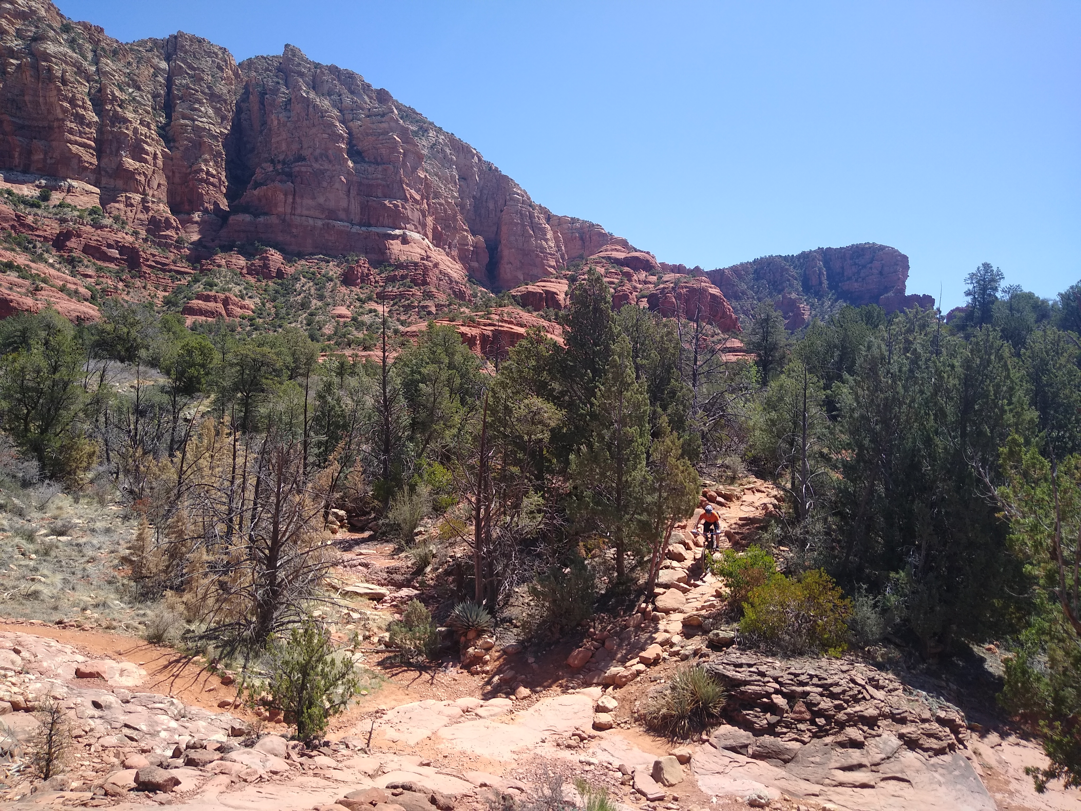
We arrived yesterday on Friday.  The trailhead area just walking distance from the resort is called The Western Gateway (Cultural Center) a part of the Dry Creek area, and the forest Service has spent the last few years building new trails, re-routing old trails, adopting user built, non-system trails, closing user built trails, and installing great signage.  And all of it has been a great improvement.  Much to our surprise, the parking lot was quite empty for a Saturday at 10am.  Today's ride was only 12.3 miles, but fun.

We started out descending on Stirrup, which is a user built trail that they adopted, formerly called "Plumbers Crack" which we guess was not a PC name.  The other main North-South trail, "Girdner" has numerous re-routes that keep it out of the washes to make a better ride.  After Girdner, we headed left on AZ Cypress to another left to climb on Cockscomb, staying right at the Axis intersection, so we could climb to the new trail, Ground Control.  Kevin surely enjoyed this trail, but Francine found Ground Control (black trail) a little too technical for her liking, walking much of the descent.  Next time, she will just go around on Outer Limits.

Francine walking and taking in the views west on Ground Control

Ground Control trail -- newly built Black rated

Side hilling on Ground Control

more Ground Control


Continued on Outer Limits for a brief stint, went left onto Last Frontier and left on Bolo, to descend to the hole at the wash at the intersection of Girdner, Axis, Bottom Out and Bolo.  We always dreaded the climb on Girdner up to the Cultural Center from the unavoidable hole, but the newly constructed trail, Axis, had a nice grade for the 1 mile climb of about 200 feet. We will have to see if Girdner has been rerouted.

Much to our surprise, we saw very few people.  We weren't sure where they were, as the parking lot in Boynton Canyon was full as we rode thru it.  Trails were in great shape.  We have been here when they are dustier and sandier.  They are getting wider, though.  We miss the narrow, singletrack, that we used to find out in this trail system in the Dry Creek area.  Looking forward to a great 2 weeks.  On Friday, 4/23, Kristin, Lenny, Jimmy and Pat & Larry arrive for a week.  We need to tire ourselves out on the bikes this week, so we can spend time with family.

Jan 9/10 Mt. Catherine

Hillary and Kelly on the summit of Mt. Catherine

 Made it home from work in time to get a lap up Mt. Catherine.  Snow was surprisingly good.  Good enough that I gave Kelly a call and I skied Catherine with Kelly and Hillary the next day.


Dec. 27, Snoqualmie Mt.


Aaron looks into the Slot Couloir

Hooked up with Seth and Aaron to do lap in their backyard.  Our 7am start was just late enough that a group of four had already broken trail up Snoqualmie Mountain.   We caught them as they prepared to drop into the slot couloir.   While waiting for our turn at the slot, we went ahead and tagged the summit of Snoqualmie.    Our lap into the slot was slightly frightful as the rain crust was quite strong.  One might even call it ice.  We scratched our turns into the couloir with great care to maintain good edge control with our skis.   It was about this time I noticed my new volkl blaze skis have quite a bit of sidecut.  Anyhow we survived the firm top and enjoyed a little bit better turns on the apron.   After climbing back to the frontside,  we headed up valley looking for alternative descents.   Luckily, Seth was the only one that got stuck in a ravine and had to boot his way up and out.  


Aaron


Kevin


December 22, Pineapple Basin


Rocks are a little bigger this time of year.  Our destination, up to the left.   Photo by GL

I have been lazy the last couple weeks.   Now that the lifts are turning, it usually takes a little more motivation to self propel myself up the mountains.    I had been waiting for a break in the weather, and today was the day.   Despite a short warmup the evening before, we got blessed with fresh powder.   After a brief evening rain, the temperature dropped rapidly.  It even sprinkled snow on Seattle.  Up here we had between five and ten inches.   Lower slopes had a thin crust layer below the fresh snow.  The higher slopes had enough snow to keep ski turns above the crust layer.   Hooked up with Greg for our first real tour together this year.  We were both shocked that, although we started at 10:45, the upper basin had zero tracks.   Makes the uphill that much better when you get to set the perfect skin track.   Turns were good.  


Climbing up No Fog


Greg


Kevin


Greg


Getting lower,