April 30, Tumalo Ridge to Skyliner

Broken Top
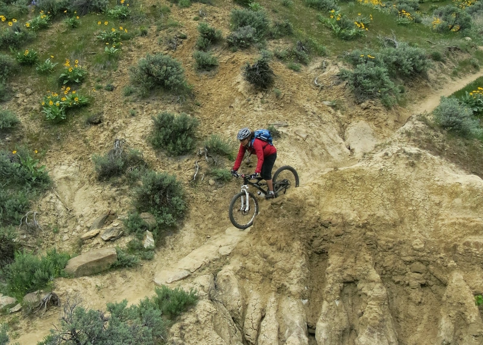
Day number Five.   Swung by the bike shop to get a USFS pass to park up Skyliner Rd.  Bike shop dude, who we have probably seen every day, asked if we were taking the day off?  Nope, just getting a later and later start.  Yes, the legs are getting a little tired after over 100 miles of singletrack riding.  Today we parked at the Skyliner Parking area, up skyliner road.  Headed out Tumalo Creek trail for about a mile to the intersection with the Tumalo Ridge Trail.  Started climbing a nice, narrow singletrack.  This eventually dumped us on a double-track climb to the ridge and the junction at the Swede Ridge Shelter.  Reached the shelter at about 5 miles. Nice views of Broken Top Mt. from the shelter(primarily winter cross country shelter).  Headed towards Swampy Shelter.  After a couple of miles, started hopping logs.   After about twenty logs we turned tail and headed downhill.
Francine at Swede Ridge Shelter


Made it back to the Swede Shelter intersection, and headed toward town on Sector 16.  This trail skirts some private property, and swoops and curves thru the trees.  Did we say that the trails are super dry?  There is no snow anywhere, and we were again at the 6000 foot level.  Descended on Upper Whoops.  Long, flowy descent for a couple of miles.  We like that this was more old-school, without all the built up berms and jumps.  Went left onto Skyliner for the ride back to the car.  Trails are in great shape, but are really dry.  Bend really needs some rain.  19 miles.

More singletrack goodness.

Cogwild Shuttle - Tiddlywinks - Storm King - Deschutes River Trails

Today, we paid for the 10:30am Cogwild Shuttle to the Wanoga Sno Park.  $15 per person.  Today would be an easy day.  Only 20.5 miles, mostly downhill.  Climbed slightly on Tiddlywinks to the descent on Tiddlywinks.  Went right on Storm King to the river.   We are usually here in later June, and Storm King was in the best condition I have seen.  At the end of Storm King, went left on the road for about 100 yards to an unmarked right on an old road turned to trail.  Rode down this for about a mile to the river.  Had a snack at the boat launch near Lava Island.  Then we coasted out on Deschutes River Trail.  We usually have about 25-30 hard miles under our legs, and the little climbs on the river trail usually seem much more difficult. Then we climbed to Hwy 46 to Marvin Gardens to C.O.D. to West Campbell Street.  Rode down thru this neighborhood to the entrance to our lodging at Mt Bachelor Village Resort.

April 28, Mrazek Trail


Mrazek


We thought we were going to have a small day, but ended being out 7 hours and rode 28 miles.  We started at Shevlin Park and chose to ride the pavement up valley for 2 miles, instead of the trail(easy warm-up).  At the end of the park, we switchbacked our way out of the park up to the flatter middle-ring rip, heading to Happy Valley.  We were hoping to make it to the Farewell Trail, as reports claimed that the snow was gone.  Unfortunately, the trail still needs one more work party to clear out blown over trees.  We came to the first blowdown and kept going.  30 blown over trees, and we were still a 1/2 mile shy of the Farewell trail intersection.  At 14 miles we decided we had hopped over enough trees and made the decision to turn around.  This was an easy decision, since we had no intention of going down  the short and steep Farewell trail.  Mrazek trail was looking far too sweet not to retrace our ascent.   Once we turned around and hopped over trees for a mile we were on a 13 mile rollercoaster back to Shevelin Park.  We typically ride Bend on Father's day.  Here we are two months early and we are seeing less snow than we typically see in June.  Trails are snowfree and dry.   They could be a tad damper, but I can not complain because the trails have pretty much been in perfect condition.  Trail is still firm and traction is great!   The corners and berms were still intact, and weren't soft and blown out.  We had an amazing fast, flowy, incredible descent.

Two Bull Fire, 2014

April 27, Tyler's Traverse, Bend Or.

View of Mt. Bachelor from the bench on Dinah-Moe Humm trail

A low snow year means we can bike higher in April than in a normal year.  We have ridden out this far from town before, with the "Bob campouts" in late June, where we ride from camp, but we wanted more energy to enjoy the trails, so we drove out to the new parking area at the junction of Storm King and Cascade Lakes Highway 46, near intersection 32.  We rode out Storm King to climb Tiddlywinks to Kiwa Butte trail.  Descended Kiwa Butte trail.  At the end, we did an out-and-back on Dinah- Moe Humm trail to the viewpoint with a bench.  After lunch, we turned around and made our way back to Tyler's Traverse.  Descended both the upper and lower sections of Tyler's Traverse. This is a seriously long descent!  Awesome new addition to the Bend trail network.  It was so long had to stop multiple times to rest. At the bottom, we climbed the shady doubletrack uphill route on Tyler's to the Steve Larsen intersection.  We turned right and headed down Steve Larsen to Tiddlywinks to Storm King and back to the car.  Low miles day, considering these are "Bend miles" at 27 miles.  Nice 77 degrees today.  Fun to ride new trails to us.  Really nice loop, except for the climb up tiddlywinks(Funner might have been an easier climb, but was 4 miles longer.)  Both Tylers, and Larsen Traverse were super sweet downhills.  Ahem, can I say that again.   Long, fast, and flowy.

Francine on Tyler's traverse trail

Kevin

Still going down on Tyler's

Rocks

April 26, Phils Trails, Bend Or.

Planned to head to Whistler, but with forecasts for rain and 50 degree weather, we decided to head South to sunshine and 70 degree weather.   After driving to Bend, we biked over to Pine Mt. Sports for the latest mountain bike map.   We then headed to Phil's trailhead for a great evening loop.  Ended up doing about 16 miles.

April 25, Moto Taneum


Vic waves for the camera.  Excellent day at Taneum.   Dirt was moist and tacky.   At high elevations we got a dusting of new snow, but otherwise all the lower trails were in good shape and snow free.  

April 23, Sage Again, Wenatchee


Still good.   Worth the drive.  

April 18, Rosy Boa, Leavenworth, Wa.

Francine - Rosy Boa Trail

Finally made it to the "Ski Hill" in Leavenworth to check out what they have been doing to link the town side of the ridge to the Freund Canyon area.   New trail last year, "For the Boys", contours out of the Ski Hill cross country area up to a nice viewpoint where "Rosy Boa" finishes.   At this junction they have a rising traverse that takes you to the bottom third of the Freund Canyon downhill.   This old road "Freund descent" was put back in service for logging last year, but efforts have been made to decommision the road, add berms, and generally make it more trail like.   From the bottom of the downhill we put it in low gear and started the trudge to the top of Freund.   After a little over a mile the road switched over to narrow, singletrack, albeit steep singletrack, that climbed the shady backside of the ridge.   At the top we headed down upper Freund downhill for about half a mile, which was in great shape.   At the next junction we headed right to Rosy Boa.   Trail drops off edge of road, easy to miss.   Evidently this ridge trail has been around for a while, but has had several new sections benched into the steep hillside.   Francine walked a couple of the steep switchbacks.   Fun to do a new trail, but sure dropped elevation quick.  The Freund Canyon loop has never been a favorite, but looks like the locals are steadily working to make it better.   Really nice to be able to start at the ski hill.   With stronger legs, it would be nice to do a double loop incorporating the whole Freund downhill with Rosy Boa.  11.9 miles.

Rosy Boa

Still on Rosy Boa

April 10, Sage Hills, Wenatchee

We try to hit Sage Hills early in the season, when the hills are still green.  The entire area is shut down over the winter to protect the mule deer.  We missed the April 1 opening, but the trails were still in stellar condition.  It's hard to believe how green these "brown" hills above Wenatchee become in the spring.  The Balsam root (yellow flower) and Lupine were in full bloom.  We started on fifth avenue, "Lester Trail", at the southwest corner of Wenatchee and worked our way up onto the ridge tops.  We managed to find a couple, new to us, trails.  Always a great ride - Sage Hills 17.5 miles.

Francine climbs on "Homestead Trail". Trail snakes down the hillside

Mule deer check us out.  Lot's of deer.

Francine with the Stuart range in the distance

Headed down on Lightning Creek trail

Full Bloomage!

Classic shot of the gulley crossing on the bottom section of "Lone Fir" trail.


April 9, Moto in the backyard

I have been out on the ktm quite a bit this spring.  What else to do when there is no snow?   Took Francine up to Windy Pass today.

Francine at Windy Pass

Snow - dusting up high

Ran out of dirt on North side of Lake Keechelus.

April 2, Rat Pack

Rat Pack - trail a little wet, but good shape.

View of Mt. Stuart from Cle Elum Ridge