Sept 21, Roslyn/ Rat Pack/ Canyon #6

Decided to head east to avoid the rain.  Trails were primo above Roslyn. then we hit Rat Pack, which was about as good as I have seen it.  Still not fully wiped out, we climbed the logging road back up towards the ridge and dropped into Canyon #6 to finish in Roslyn.  Beautiful day.  13.5 miles.

Trail conditions were making Francine happy

Steep

Same shot - zoomed in.

Sept. 12, Roberts Creek Trails, Sunshine Coast BC

Kevin switchbacks down Highway 103


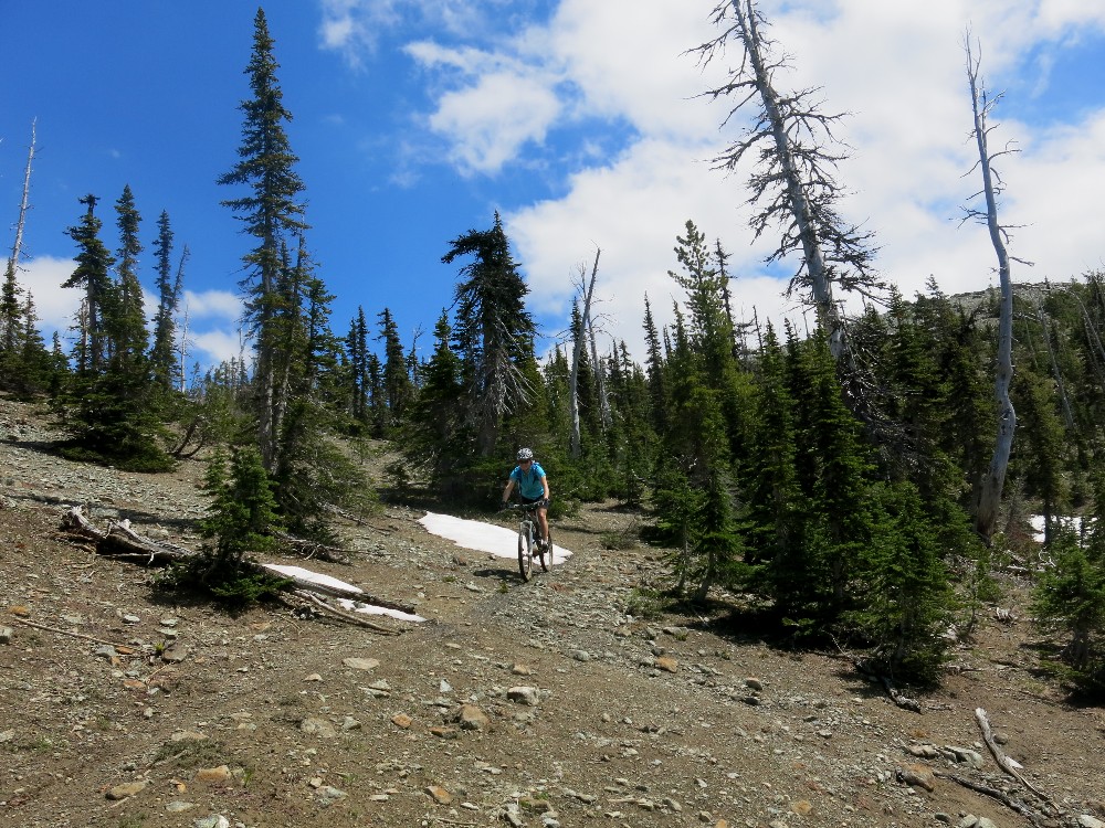
Yesterday we rode the Hwy 102 trail.  Today, we need to ride the Hwy 103 trail.  When we were bombing down the mystery trail two days ago, we ran into a biker.  She told us how she climbs the trails in the area, so we followed her advice.  We parked in the same spot under the powerlines, like two days ago.  We headed out the Powerlines to climb on Black Tower.  Took that all the way to Cunning Stunts.  Climbed to the road and went up DNZ, as it was in the shade compared to the road.  We were climbing a downhill flow trail with jumps, rollers and gaps.  But generally, we could go around the features.  Hit a doubletrack and continued climbing.  Originally, we were going to climb Janet's Jungle, to get up to the Dude's Bypass trail.  Janet's Jungle trail was going straight up hill, so we continued our nice contour on the doubletrack.  After two more intersections, we were at the bottom of Grant's Grind, where we were two days ago.  Continued on the double track to the next right, and climbed the double track that turned to trail in the clearcut.  Hit a double track and went left.  Didn't go right at the next intersection, but went right at the second intersection, which put us at the bottom of Guy's Gulch, where we had been 2 days ago.  We were so beat at this point two days ago.  Our route choice up today was much easier.

Yet, another bridge, this one crossing a big creek.  Hwy 103 Trail.


Headed up Guy's Gulch to the doubletrack, went right, and made our way to the start of Hwy 103 trail.  Continued climbing on the 103 trail to the top.  On the descent we went right on Red Baron Trail, a "blue square" trail.  This basically went straight down the mountain.  Another painful loss of elevation for Francine, who did quite a bit of walking.  Hit the road, went right, and left onto Charlie Brown to Pumpkin Patch to Lost'n'Found to Patrick's Pass to Black Tower.   Once we hit the powerlines, Francine opted to take Black Tower down to the house, like two days ago. 

Tomorrow we pack up and head home.  Oh - tomorrow is our 16th wedding anniversary.


Sept. 11, Sprockids Mountain Bike Park, Gibsons, BC

5 Way - Heading out Hwy 101 trail to Hwy 102 trail

 We originally discussed driving to Gibsons (15 minutes?) to park the car at the Langdale Ferry, taking the bus back to the house, and starting a point-to-point ride to the car, utilizing a big climb to Hwy 103 trail to Hwy 102 trail to Sprockids Park descending all the way to the ferry at Langdale.  We quickly lost enthusiasm for organizing the bus thing.  So, we drove to the Sprockids Mountain Bike Park in Gibsons instead. 


Lots of practice riding log bridges


We climbed the doubletrack from the car to the Skills Centre.  Found Rock’n’Root to start climbing on Technical Ecstacy to Sidewinder.  We really enjoyed the buff, pine needled trail conditions on Sidewinder.  They even made the steep grade somewhat tolerable.  At a 5 way, went straight onto Hwy 101 trail to Hwy 102 trail.  Continued our climb on the Hwy 102 trail to its end at the B&K Logging road.  Turned around and bombed back on Hwy 102 trail to the 5 way.  Here, we continued up on Sidewinder Up.  Continued up on Pressure Drop.  Went thru many intersections, staying on Pressure Drop.  The signage in the Park is great, but there wasn’t always a “you are here” marker, so you didn’t always know where you were on the map.  Bypassed “Torrent Trail” as the sign said it was REAL steep.  So was Pressure Drop, which was a painful loss of elevation, straight down the hillside.  Ended up on Upper Flume and Lower Flume.  Right next to Upper flume was a nice looking Flow type trail that we should have taken.  Went by the sign that said “Trial to the Ferry”, so since we didn’t park waaay down there, we went right, and the trail dropped us out right at the car.  Nice way to end the ride.  14 miles.Headed


Sept. 10, Roberts Creek, Sunshine Coast BC


Today we rode out the Powerlines, up Black Tower to Patrick’s Pass to Lost’n’Found to continue climbing up Pumpkin Patch, which was on the edge of a clear cut.  Went left on a dirt road to the main B&K logging road.  Climbed about ¼ mile and went left at the next road intersection for another ¼ mile to find Dude’s Bypass on the left.  Contoured here, and took the third left down on Grant’s Grind.  This dropped us out on a doubletrack dirt road where we went right and right again at the next intersection.  We  climbed the double track which turned into singletrack near a clearcut.  Hit another doubletrack, went left and right again, still climbing.  Saw a faint trail on the left and took that.  Hit an intersection, went right and started heading straight up.  Continued up and up, with much hike-a-biking until we hit a road. 
We were confused as this trail did not seem to be on the map, but we found our location by turning right on this road to the next intersection, where we found the start of Hwy 103 trail.  We were fairly pooped, and thought we just climbed Suzies Q, but it wasn’t on the correct place on the map.  So, we bombed down the mystery trail we just climbed.  Went right at the intersection we were at earlier and contoured over to the bottom of Guy’s Gulch trail at a 4 way.  Save that one for another day.  Went straight onto Up’n’Over and down to JB Connector.  Climbed this to the doubletrack and went left at the next intersection to climb to the Mach Chicken Downhill.  Descended and crossed a road and continued our descent onto Sleepy Hollow.  Crossed another road and rode out Rod’s Rocky Road to the Circle Loop.  Circle Loop had been clearcut, so rode around the circle down to the powerline road.  Went left to the car.

Francine added on about 1.5 miles, by continuing out the powerlines about ½ a mile to take a right onto Black Tower.  This trail dropped down to Malcom Creek Road which crossed the highway 101.  Descended on gravel road to a “T” and went right.  At the end of the street was a trail that cut thru the woods “Roberts Creek S??? District public way trail that dropped out on Robinson and a left onto a street just opposite from our treet, Stephens.  Sweet descent to the house.  14 miles.

Sept. 9, Roberts Creek Oceanfront House, Sunshine Coast BC


Todday, we moved into our waterfront beach house.  We took today off from biking and relaxed in the hottub and Adirondack chairs on the lawn.

Kevin basking in the sun


Francine hiding in the shade

 
Early Morning Calm


Sept, 8, West Sechelt, Sunshine Coast B.C.

Day two found us with weary legs and some steep climbs.  Last nights ride was a little longer than we planned.  The guy in the bike shop yesterday recommended we start today’s ride from our B&B, but since this ride went higher than last night’s ride, we opted to park the car higher.  The trails around here are quite steep. 


Log bridge practice

Francine riding a wide log bridge
 

Headed up super steep Duroid Hill Road, hike-a-biking most of the way, about a mile.  Saw a faint doubletrack that was hopefully our trail.  Went left and continued our climb onto Easy Street, right onto Over Easy and started contouring on Desoto.  Went down on Skullduggery to Beaver Pond.  Climbed to Crowston Lake on Parbac to really start climbing on VFR.  This lead to a steep downhill VFR. Rode VFR to the bottom of Addernach to Lees’s Big Easy, the low point of the ride.  Now we started climbing again to get to the car.  Rode 4D to 3D to the PowerLine trail back to the car.  13 miles. 

Sept 7, Sunshine Coast - Halfmoon Bay

Ferry boat ride to the Sunshine Coast, B.C.
We checked into Nestledown B&B for a 2 night stay in the Halfmoon Bay area.  We think the Sunshine Coast is to Vancouver, like the San Juans are to Seattle.  Only a 45 minute ferry ride from Vancouver gets you to the Sunshine Coast.  Rushed out to ride, at 4pm. 
Rode up Litttle Knives trail in Halfmoon Bay
Rolled down the Lower Road to Sargeant Bay Provincial Park to start our ride.  Headed up Roller Coaster and up Little Knives to the Highway (101).  We rode on gorgeous, moss and pine needle covered trails.  Signage was also nice.  Crossed the highway to Trout Lake.  Then headed on Lumpy, back to the Highway.  Headed up June and up Missing Link, Wally and Fork Off, still climbing up to Woodpecker Ridge.  Finally, after about 7 miles, we started heading downhill. 
Lots of moss and pine needles.

Francine
Hit Datsun Alley to Pterodactyl.  Took a new trail off of Pterodactyl, called Toe.  This took us down, bordering private houses, and well below where we needed to be.  The next trail was called Tac, and we started climbing again.  We were ready to be done, as we needed to eat dinner.  We assumed we still needed to ride Tic, and were still climbing.  After Tic, we kept climbing on Out & In.  Hit Sprockids Run to the school, which finally stopped climbing.  From here it was a long downhill on pavement to the B&B.  Had we known the local trails a little better, and had a better map (which we purchased later), we could have stayed on trails longer.  12.4 miles.

August 30, Crystal Mt.

Crystal Mt. ride with Chris, Corrine, Heather, and Francine.  Trail was a major grunt going up, but was in great shape for the descent.   Always a tough, fun, ride.

Heather leads the pack up the ridge.

Heather, Francine, Chris, Corrine, and Kevin
Mt. Rainier is obscured in the gray.

Chris cruising down Lucky Shot

Corrine drops down to Lower Henskin Lake

August 29, Miller Peak

As usual, great ride.

Vic - Miller Peak in background


August 27, Moto the Middle Fork

Went creeking on the Middle Fork of the Teanaway with Vic.  Unfortunately the first creek flooded Vic's bike and it sputtered most of the rest of the day.  After about 8 crossings and lots of brush we gave up and turned around.

Vic with wet feet

Skirting the deep end on our way home.


August 11, Duthie Ride

Hooked up with Chris, Heather, and Mike, with Eleni in the backpack, to do some laps at Duthie.  Trails were in great shape and it's always fun to see so many mountain bikers in one place.  

Kevin, Mike, and Eleni (future mountain biker)

August 5, Post Canyon / Windsurf

We took yesterday off from riding.  This morning we got up bright and early and did another ride at Post Canyon before we had to check out of our rental house.  The wind was picking up, so decided to windsurf for a couple of hours, before heading home.  Wind was really nice and steady and made for a great day.

Kevin starting to get up on a plane.  Consistent winds with a 6.0 sail made for a fun day.

August 3, 2013, Hood River Day 3 – High Prairie

Francine climbing Cook's Meadow trail

Our legs are getting a little tired.  Even though our rides have been short, there seems to be a lot of climbing on the rides.   We decided to do a new ride for us, High Prairie.  We parked at the intersection of Forest Road 44 and FR120 at elev. 4550 feet. Went west on FR44, and painfully descended on pavement about 2.5 miles and approx. 500 feet to Surveryor’s Ridge Trail #688.  (In the future, we would recommend climbing Trail 474 to FR 1720.  Left here to FR44, to hopefully get a trail descent instead.) 

Rode Trail #688 for about ¼ mile and went left on Cooks Meadow Trail #639 at 2.7 miles.  The trail immediately crosses FR44, and starts out with a good grunt, making you think you will be hike-a-biking for miles.  Luckily, it has seen re-routes with rideable switchbacks and traverses across the hill, definitely made by mountain bikers.  Even though this was a grunt, the grade was really rideable for almost the entire trail.  This trail was in great condition for Hood River in August.  We climbed up to around 5,200 feet and descended a couple of hundred feet to gravel FR4410 at 6.7 miles.  Went left here and climbed 2 miles to 6,000 feet at High Prairie.  Went left on FR4420 and descended for 1.2 miles to the Eight Mile Creek Trail #450.  Here we went left on the trail #450 for our 4.5 mile descent to the car.  Bypassed the 15 mile creek trail on the right on our way down.  Trails were in great condition.  Fun ride.  15 miles.

Cruising downhill at the junction of 8 mile and 15 mile creek trails

August 2, 2013 – Hood River Day 2 - Whoopdee Trail to Whoop it Up & Kevin Windsurfing

It was still windy, so Kevin wanted to get out and windsurf, so we made our way to The Event Site where Kevin rented a 115 Litre Board with 5.0m sail for a couple of hours.

Kevin checks to see that he still
remebers how to sail.


Fire danger meant that the Whoopdee Trail, and others on private land owned by SDS Lumber Company, were closing at the end of today, so we had to ride it.  Plus, earlier this spring, they just finished putting in a new trail to replace the old jeep road climb at the end of the ride (approx. 900 feet climb), that climbs back to Old Dalles Road, and we had to check that out.  From the car (elev. 1500’), we climbed Old Dalles Drive, which is now paved (sweet), for about 2 miles to the start of the Whoopdee Trail (elev. 2000’).  There is a new trailhead, at the exit end of the one-way loop trail, for those that wish to skip the “Puke Hill” portion of the ride.


After Post Canyon, the Whoopdee trail conditions were superb.  The trail was basically hard pan all the way.  Even in the clear cuts, the trail was sweet.  As this trail is on private property, and the landowner does not wish maps posted, it must see less use, as evidenced by the trail conditions.  Played a little tag, back and forth with a couple of guys from Bellevue and Los Angeles. 


After our big long descent, we hit our climb out (low point elev. 1140’) on Whoop It Up, the new trail.  Signage was nice here.  They did a nice job of re-routing and building a new trail to replace the jeep road climb.  The climbing was a grunt at the end of a ride, but the grade was perfect for the climb out.  You can tell that Whoop It Up was made by mountain bikers for mountain bikers.   I don’t remember this being a 14 mile ride, but all the countless, rideable, switchbacks mean you can stay on your bike, rest in between switchbacks, and ride in the shade.

We hit the Old Dalles Road again after about 12 miles.  Went right towards the car for about ¼ mile to the start of the “Puke Hill” trail section.  Went left and began climbing again.  Climbed a couple of hills to 2,160 feet.  Descended a screaming, fast, brushed in section of trail down to the car at elevation of 1,500 feet.  I am sure we burned up some brake pads here.  14.5 miles.

Francine rides up the ridge for the puke hill downhill.
Mt. hood in the distance


August 1, 2013 – Hood River Day 1 - Post Canyon

Camping in style.  Great house in upper Hood River.

We originally planned on riding in Baker City, Oregon, with Don and Val.  Unfortunately, Don's dad got sick, and that weekend was off.

Where to go?  Thought about Vancouver Island, BC, but this weekend is a Canada 3 day weekend, so Canada was out.  We seriously got the last house for rent in Hood River.  The town is full.   We arrived in Hood River this afternoon, checked in to our house, and headed out for a ride around 4pm.  We parked at the “Post Canyon Staging area”, the lowest parking lot.  After the ice storm a couple of years ago, the mile or so section of trail starting at this parking area was closed off by the property owner.  So, we climbed the road about a mile.  Rode up Seven Streams (#100) to the 100Loop trail.  We rode up to the Family Man area.  Rode around a little on the wood skinnies, and made our way out 8Track (#150).  The Seven Streams trail below 8Track was real beat up and hammered, but  Once we hit 8Track, trail conditions improved.  As we climbed, we skipped The Boot Loop (lazy) as we wound and climbed and grunted our way to Upper 8Track.  They have done an amazing job making steep, climbable trails.  Did we mention that it was windy and cold up here?  Who would have guessed we could have used more clothing?

Now for the descent on Bad Motor Scooter (#158).  This is a new trail, made in the freeride fashion, with berms and steep up and downs in between the bermed corners.  Was a little bumpy.  Crossed Riordan Road and headed down on GP (still #158).  At the intersection with #105, we opted for the XC (Cross Country oriented trail, as opposed to the Freeride version of GP, and went right on #105, to #120 where we started descending.  Hit Road 1200, went right for 50 feet and went left on #118 and continued descending.  Came to a new intersection to us, with Charley’s Trail (#120L).  We missed the L, which means loop.  This super narrow singletrack wound around back to point we had already been.  Below us, we could see the trail we wanted to be on to get back to the car.  Took the connector down to the 100L trail, and retraced our steps back to the car.
Fun ride, but we are used to these trails in April or May, when they are tacky and damp, and less beat up.  Trail conditions kept you on your toes with the clay, roller ball bearings, adding excitement to the off camber sections.  13 miles.

Francine forges through the brush
on Charleys trail.
Francine plans the next ride.

July 24, Taneum Motorcycle Ride

Hooked up with Vic and got beat up in the whoops and  roots of the Taneum trail system.

July 22, CCC road

With all the dry weather, the Middle Fork Trail was looking like a nice shady option.  Unfortunately those pesky hikers have us kicked off the trail on even days.  Well, we reassessed and opted for the CCC road.  Built by the civilian conservation corps back in the depression days.  It starts out past the Mt. Si trail and runs up the West side of the Middle fork of the Snoqualmie.  It finsishes where the Middle Fork Trail starts.  Out and back 24 miles.  Good fitness ride and we dragged Scott Sumner along to make him feel tired.

Scott cruises in the shade

Francine


June 28, Esmerelda Basin

Headed out to the Teanaway to do a circumnavigation of Esmerelda Peak.  Unfortunately as we dropped over the North side of our route we realized that the route was still covered in too much snow.  Still we made it to the top Esmerelda Basin and enjoyed the out and back trail ride.

Francine cresting out on the ridgetop.
Esmerelda Peak in the background.

Kevin enjoys the views

We tried dropping off the backside,  but ended up turning around
due to the large amount of snow remaining down in the shaded areas.

Francine heads back down on the Esmerelda basin trail.

June 20, Tronsen Ridge to Devil's Gulch

Got out on the dirt bike for a 53 mile ride.  Tight singletrack.

Scott Sumner

Nice trail.

Vic

Vic


June 8-9, Mt. Baker: Squak Glacier Route


Kevin, excited about the free human poop bags.
 It's going to be a fun two days.  Starting elevation was 3,300 feet.
Car was parked about a qurter mile from Schreiber's  Meadows.

Greg and Kelly relax at our camp, Crag View elev. 6513.
First day elevation gain 3,200 feet.  Weight of our packs
filled with lightweight gear - a lot!

Gourmet dinner of chicken and rice.

Kelly in his bivy.  Nice view of the Easton drainage

Morning cup of Starbuck's Via 

Kelly starts skinning up the Squak glacier, day 2.

Kelly and Kevin

We brought our rope, so pulled it out for one section of the climb,
although the crevasse danger seemed minimal.

Greg heads for the Roman Wall

Kelly, in crampons, heads up the Roman Wall.
Deming Glacier looks well crevassed below.

Kevin, Kelly, and Greg

Summit of Mt. Baker.  Elev. 10,781ft.
Vertical gain day 2 was 4,270 feet.

Kevin

Kevin in the fog below

Kelly

Greg


Greg

Kelly